The Domesday book was William of Normandy’s great survey of England, as he consolidated his realm after his invasion of England in 1066 – though the Domesday Book wasn’t begun until 1085. As the Anglo-Saxon Chronicle has it:
Then, at the midwinter, was the king in Gloucester with his council … . After this had the king a large meeting, and very deep consultation with his council, about this land; how it was occupied, and by what sort of men. Then sent he his men over all England into each shire; commissioning them to find out “How many hundreds of hides were in the shire, what land the king himself had, and what stock upon the land; or, what dues he ought to have by the year from the shire.”
Contrary to popular belief, William the Bastard (as he was better known at the time) didn’t achieve victory in 1066. It took several bloody years to subdue England. In some parts of the country – in the north and the west – his troops carried out what can only be described as ethnic cleansing of the Anglo-Saxon and Norse populations.
Nevertheless, the Domesday Book is very useful for historians. I often referred to it when I was writing topographical books and articles in the past. But, in reality, the Domesday Book is a snapshot of late Anglo-Saxon England, for the Normans were had only just begun to make their mark by 1085.
So it always comes as a surprise that you can walk in parts of England that get no mention at all in the Domesday Book, as we did the other day. For much of what we now call Cumbria doesn’t feature in Domesday at all. Why Not? Because at the time they were not in England at all – they were in Scotland. And even then they were mostly settled by Norsemen. The Vikings who had gone beyond raiding, settling instead.
In Westmorland, not far from Appleby, is the Hoff Beck (two Norse words) and the fact that the Eden Rivers Trust has established a walk along some of its length, describing our walk from Bandley Bridge (first recorded as a crossing place in 1292) to Rutter Force. (Force – another Norse word).
The other day, we strolled the other part of the Hoff Beck walk to the settlement of Colby – another place, like nearby Appleby, settled by the Norse folk. Look at the -by at the end of those names. A clear indicator of a place-name of Norse origins. Appleby might have gone on to be the County Town of Westmorland, and, even though a Roman road ran by it, it probably didn’t exist before the Vikings settled there.
Bandley Bridge is interesting, for though the footbridge is relatively modern, there must probably have always been a bridge there, for there is no obvious ford and the 1292 record specifically refers to a brig or bridge.
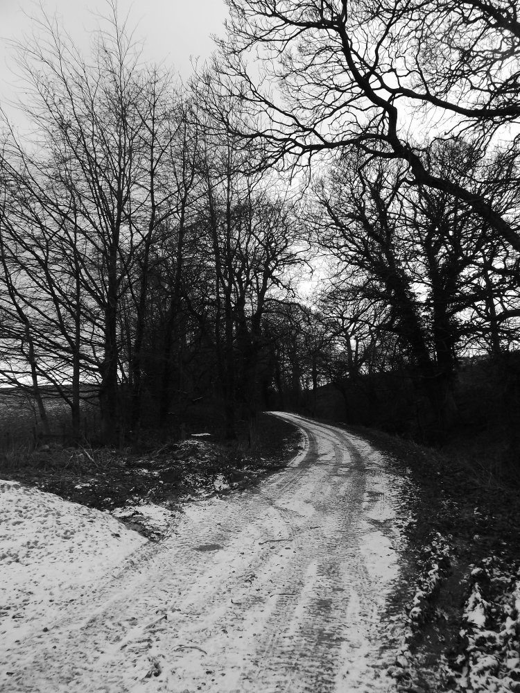
It’s in lonely countryside, walked mostly by locals and those ramblers who’ve sought out the Dales High Way track across and around the Pennines. It’s a place full of atmosphere too, probably not changed that much since those ancient times.
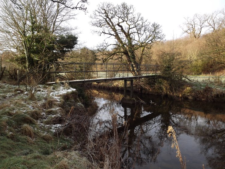
We followed the Hoff Beck down to Colby, where the little river becomes the Colby Beck, before seeking out the greater waters of the River Eden. A long drawn-out hamlet, Colby, of cottages of varying ages. No doubt many built on sites that were used a thousand years ago. And, in a gap between the settlements, there’s a field full of bumps and mounds, which might repay some archaeological investigation. I often wonder if it was the site of the original Norse settlement.
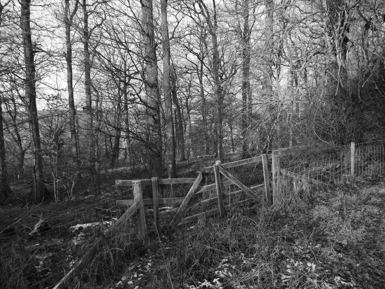
We crossed the Colby Beck at a bridge over what was clearly an ancient fording place, and took the farm track towards Colby Laithes. Go beyond the farm and there’s a set of large stepping stones not marked on the Ordnance Survey map, but which look as though they’ve been there for centuries. You can cross them and follow the River Eden much of the way back to Appleby.
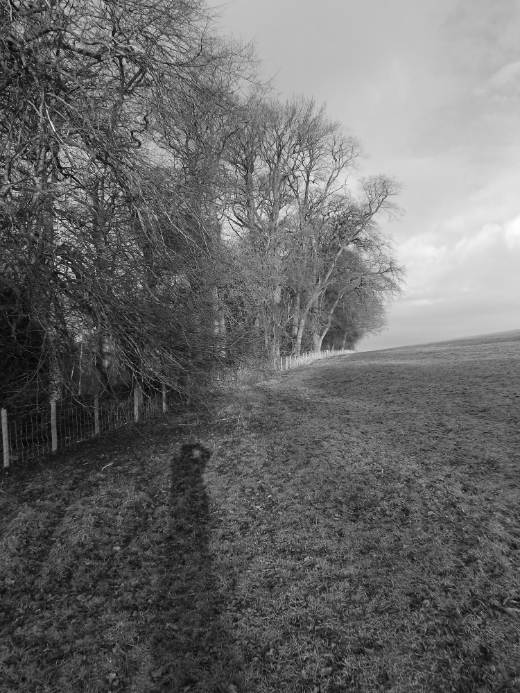
We didn’t, preferring the higher path over Thistly Hill, which offered fine views over the snow-covered Pennines. An old track this, for although it seems to be a headland path around the edges of fields, it is wider than most headland paths and distinct on level and vegetation from the neighbouring fields, suggesting that this is a old way, from which the hedge on one side has been removed.
It eventually enters woodland just before Appleby, at an interesting junction with another old track coming up from the river. Paths that have almost certainly existed for centuries, and perhaps for the thousand years when this was all the territory of the Norsemen, part of Scotland, and way outside William the Bastard’s Domesday Book.

It’s my imagination of course but it always feels ‘viking’ up there.
LikeLiked by 1 person
It does.
LikeLike
If Harold had beaten William, I wonder if Cumbria would have remained as part of Scotland? Interesting post, John, thank you.
LikeLiked by 1 person
Very likely, I think. And we’d probably all have been Scandinavians too.
LikeLiked by 1 person
That would certainly make today’s United Kingdom a different place.
LikeLiked by 1 person
It would.
LikeLiked by 1 person
I believe you have snow on your hills yet again this week? Richard came up on the train and said a lot of your higher hills had quite a bit.
LikeLiked by 1 person
Just a touch around Cross Fell
LikeLike
All gone now.
LikeLike
Yeah – we saw it had gone today driving round to High Pike
LikeLiked by 1 person
There was a tiny bit on the Langdales.
LikeLike
There’s quite a bit along the steep edge of Helvellyn above the tarn
LikeLiked by 1 person
Ages since we’ve walked in the Lakes.
LikeLike
so were you walking down Langdale or did you just see it from a distance? We just saw the snow on Helvellyn from our usual northern fells
LikeLiked by 1 person
No, actually we were looking right across from Scout Scar.
LikeLike
Some of our paths and tracks are very old indeed – one of the delights of learning geography, how to identify the old ways beneath our modern roads.
LikeLiked by 1 person
Indeed, I’ve been reading Jack Cornish’s new book the Lost Paths, which I hope to review next week. A very good account of path origins.
LikeLike